 Wildflower Search Plant Distribution Map
About this Map
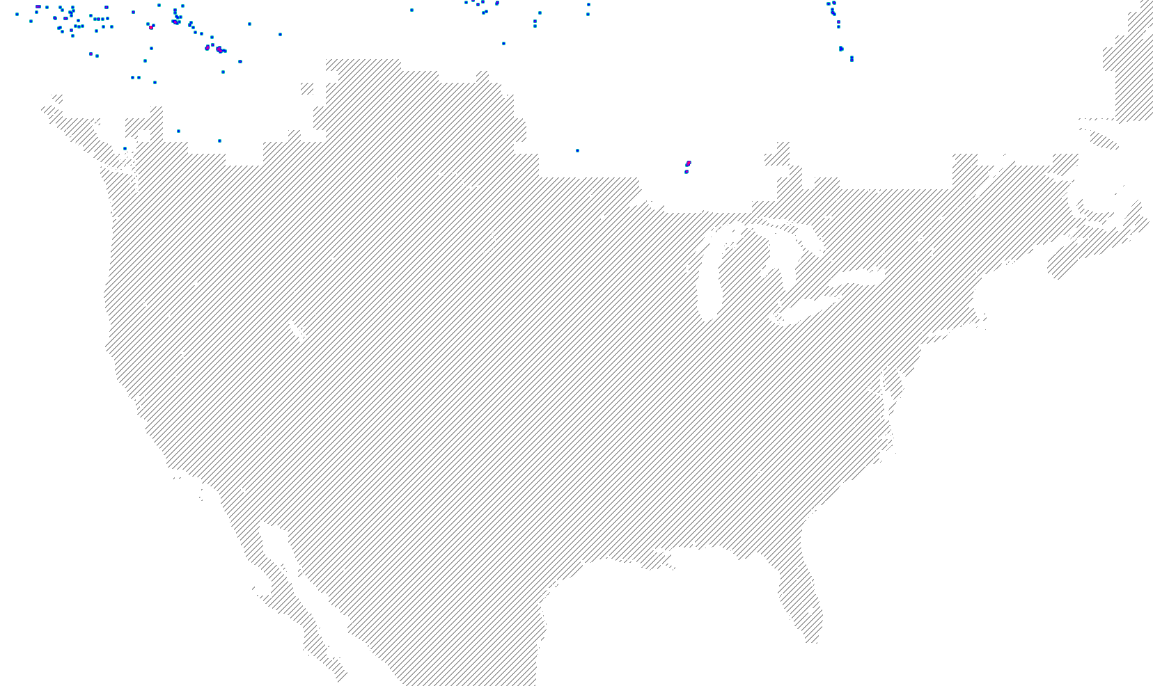
This map shows where the plant Saxifraga tricuspidata has been found. When a plant has been collected at a specific place there is a blue dot on the map. When many plants have been collected the color of the dot is made darker, then redder. When there is a record of the plant growing in a county the county is shown in the normal color. Otherwise, the county has a white overlay. The location search algorithm assumes the plant will never be found in areas with crosshatching. The data displayed in this map is incomplete and occasionally contains errors.
Distribution Map License
The map your browser is displaying is composed of two parts. Each part is licensed. The background map is a Stamen terrain map built by visiting maps.stamen.com. It has the following attribution: Map tiles by Stamen Design, under CC BY 3.0. Data by OpenStreetMap, under ODbL.
Displayed over the terrain map is a partially transparent overlay that shows where the species has been found. This overlay uses data from many sources listed at this Attribution and Copyright link. This overlay is licensed under a Creative Commons Attribution-NonCommercial-ShareAlike license.